
Painted Stone Site: Geographic Location
Machine translation from the original, not yet reviewed by the author.
Original in Spanish
Where Is the Stone?
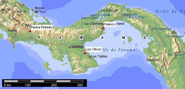
The exact coordinates of the stone are 08°39.373N 082°22.057W WGS84 at 378 meters above sea level. For the general location of the ‘Painted Stone’ in Panama, see map #1, which also shows other petroglyph sites. North is up. The red dots indicate the approximate places where the stones are. Click on the image to see the full map (generated with Microsoft World Atlas).
How Do You Get There?
The stone is in the village of Calderas, district of Boquete, province of Chiriquí, in the Republic of Panama.
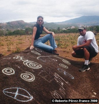
The photograph above these lines was taken from on top of the Painted Stone, showing some mountains in the background. This landscape is very characteristic of Boquete. Some drawings were marked with chalk for contrast. As we can see, spirals also appear on this stone, such as those found on so many other petroglyphs, including those of Polanco and Los Olivos.
Next we will describe the route from the city of David, Chiriquí, to the Painted Stone of Calderas. All the coordinates we will give below are given in the WGS84 datum, in the format Degrees°Minutes North, Degrees°Minutes West and meters above sea level.
The starting point we will take to describe the access route to the Painted Stone is the city of David. Position yourself at the entrance to Boquete, which is across from the Super Mercado Barú. This intersection was formerly known as “the three gas stations,” because on three of its four corners there were gas stations. The coordinates of this point are 08°26.728N 082°25.325W 86m. The entrance to Calderas is 26.5 km from this point.
Drive to the Potrerillos fork (Y), which is at the coordinates 08°34.607N 082°25.354W 306m. Do not stop there. At the fork, take the right.
Keep driving until the entrance to Calderas. This entrance is at the coordinates 08°40.079N 082°26.771W 684m. You will see the entrance on your right.
The village of Calderas is 12 km from that entrance. You can park your vehicle at the point with the coordinates 08°39.570N 082°22.180W 389m. From there on you will have to continue on foot. The stone is so famous that its location is marked (thank God!) by signs on the road that say “PIEDRA PINTADA.” Really, these signs and the directions of the locals are enough to find it.
The stone is 350 meters into a pasture, exactly at the coordinates 08°39.373N 082°22.057W 378m.
Notes
Note: As some specialists informed me later, chalking petroglyphs is not a recommended practice in some cases. For that reason, I ask visitors to the stone not to mark the carvings with chalk, paint or any other substance.
Next page: Location of the calendar on the stone